
Walk a Greenwood Street Directory
A street search works best as a chain of dated facts. First fix the address, since a missing unit, direction, or suffix can point to the wrong Greenwood parcel. Next use the assessor and map layers to identify the parcel and its geography. The deed index answers a different question: which instruments transferred or affected title. Permit files show work at the site and the people or firms involved in that work. Voter information and historical directories have their own access rules and dates, so neither should be merged into a claim about who occupies a home now.
- Standardize the full address, including direction, road suffix, unit, postal city, and ZIP.
- Search Johnson County Beacon by address and save the parcel ID and displayed assessment details.
- Check adjacent points and boundary layers in Greenwood ArcGIS, then note municipality, township, school boundary, and parcel context.
- Use the parcel and owner spelling in the Johnson County Recorder routes, searching both grantor and grantee roles.
- Compare dated permits and older directories, recording what each source actually calls the named person.
This sequence turns the street directory into an evidence trail. It can connect a site address, assessed owner, recorded party, and historic listing, but it does not erase the difference among them. If the goal is one named person rather than a whole road, the Greenwood resident lookup uses a narrower name-first method.
Normalize Greenwood Street Addresses
Keep every part of a Greenwood address before searching: the number or number range, prefix, road name, road suffix, second suffix, unit type, and unit identifier. Postal city and ZIP belong in the note too. They help find a mailing address, but neither proves that the site lies inside Greenwood's municipal boundary. The city address layer adds township, section, range, municipality, subdivision or place name, address-point ID, site-address ID, and a verification flag when those fields are present.
- Parcel
- A mapped piece of land identified for assessment and record purposes.
- Situs address
- The physical location assigned to a parcel, which may differ from the owner's mailing address.
- Plat
- A recorded map that lays out lots, streets, and other subdivision details.
- Criss-cross directory
- A historical directory arranged by street and house number instead of only by a person's name.
A precise street directory search preserves both the printed form and the standardized form. Historical material may use an old postal city or street spelling. Modern parcel IDs can also change after a split or combination. Save the source date with each version rather than forcing all records into today's format.
Search Greenwood Address Layers
The Greenwood Address Parcel layer exposes structured place fields rather than a list of residents. Its inspected schema includes a full address, unit type, ZIP, city, postal place, township, range, section, building-permit field, comments, angle, and verification status. These fields are useful when two addresses look alike or when a road crosses more than one local geography.
| Field group | Examples captured | Street-search use |
|---|---|---|
| Address | FULLADDR2, SUFFIX2, UNITTYPE | Retains the complete site label and unit detail |
| Postal | ZIP, CITY, POSTAL | Checks mailing context without claiming city limits |
| Survey geography | TOWNSHIP, TWPNAME, RANGE, SECTION_ | Separates township and survey references |
| Record context | BLDGPERM, COMMENTS, VERIFIED | Flags permit references and address status |
The source view for Greenwood's structured layer is visible in the image below.
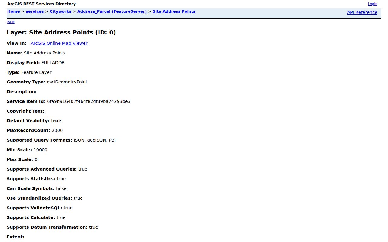
Move from the layer to Beacon when ownership and assessment context are needed. A street search in Beacon can use Search all, name, address, parcel ID, or alternate ID. Because the live fields are dynamic, do not assume each mode accepts the same input.
Separate Greenwood Street Boundaries
Greenwood's Boundaries MapServer includes Greenwood, school, and township layers. A street address can have a Greenwood mailing label while falling outside the city polygon, or sit inside the city while sharing postal geography with nearby areas. The two Greenwood-related ZIP codes are not exclusive to the city. That is why a ZIP or postal city should never stand in for a municipal boundary finding.
The boundary service shown here offers identify, find, query, map export, and related operations.
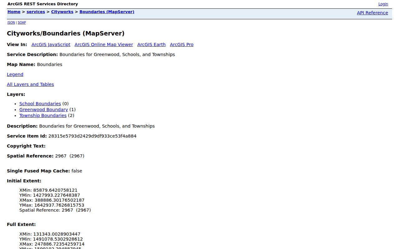
The official annexation StoryMap dates Greenwood's growth from 1973 through 2025 and links ordinances. Older map positions are cautioned as approximate, so use the linked ordinance and legal description for a precise historical boundary. Annexation can change the local government context while the printed street address stays the same.
Note: A ZIP match validates postal context, not Greenwood city limits, parcel title, or the identity of a person at the address.
Greenwood Street Records by Address
No single roll answers every street question. The table keeps the Johnson County and Greenwood sources in their proper roles. It also shows the fallback when an online result is incomplete: consult the responsible office or the physical historical collection.
| Record Set | Keeper | What It Shows | Access |
|---|---|---|---|
| Assessment and tax | Johnson County Assessor and Treasurer | Parcel, assessed owner, tax context, mailing and site details | Beacon and county tax search |
| Address and boundaries | Greenwood GIS and Johnson County GIS | Address points, parcel context, city, township, school, and imagery | Public map and REST layers |
| Recorded instruments | Johnson County Recorder | Grantor, grantee, instrument, recording date, parcel, legal description | Tapestry, Laredo, or recorder office |
| Permits and code cases | Greenwood departments | Project address, type, status, dates, applicant, contractor | Citizenserve, document reports, or records request |
| Historical directories | Indiana State Library and local collections | Dated person, street, phone, and household clues | Print, closed stack, library databases |
Use the parcel ID to bridge assessment, tax, deed, and some permit files. Search the recorded index by both owner-name roles because a grantor gives an interest and a grantee receives one. A tax name can differ from title because of billing, an entity, an earlier record, or a split parcel. The street name then serves as a separate bridge into city files and older street-order sources.
Read Greenwood Beacon Results
A Beacon parcel card is an assessment source. The official sample fields include section, township, range, property address, district, brief tax description, alternate ID, class, acreage, and owner address. Its warning says the card is not for use on legal documents. That distinction matters: an assessor record is valuable for finding the parcel, but the Recorder's instrument remains the source for a title transfer.
After locating one Greenwood parcel, compare the site address with the owner mailing address and save the card's data date. Then search the Johnson County Treasurer by parcel, name, address, district, and tax year as needed. The portal advises against filling too many fields and warns that recent split or combined property may require a last-name search. This is a useful insider detail when an exact address produces no hit.
Note: The assessed owner, taxpayer, deed party, and person living at a Greenwood address can be four different roles.
Greenwood Street Permits and Cases
The Greenwood Citizenserve search covers permits, development projects, code cases, complaints, and inspections. Search controls documented in the research include a file type, permit or case type, status, location, and other record-specific fields. Results are paginated in groups of 30. Treat the name on a file as the role shown, such as applicant, contractor, owner, or contact.
The public permit and code search appears below.
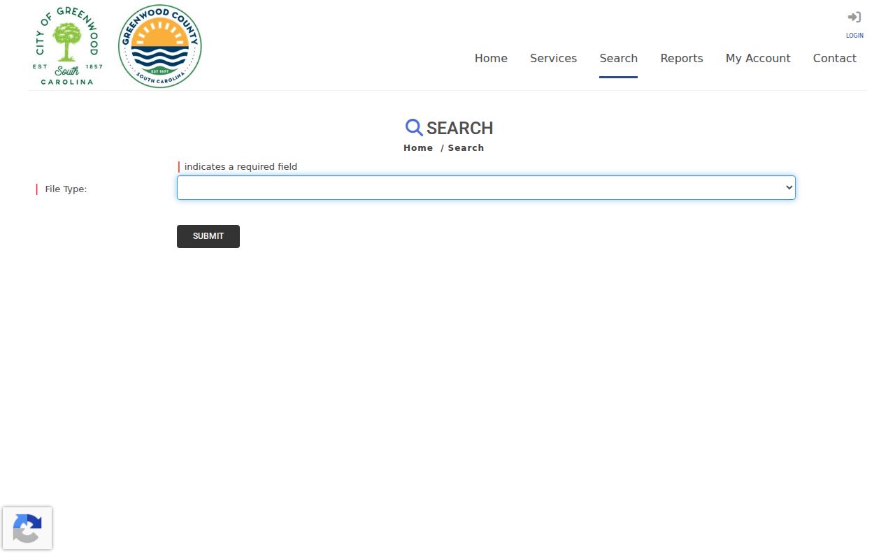
Greenwood also publishes map layers for permitting addresses. They retain site-address IDs, address-point IDs, number prefixes and suffixes, unit fields, road names, place names, and municipality. That structure is helpful when a permit uses a unit or subdivision label that differs from a tax search.
The permitting address-layer inventory is shown in this source image.
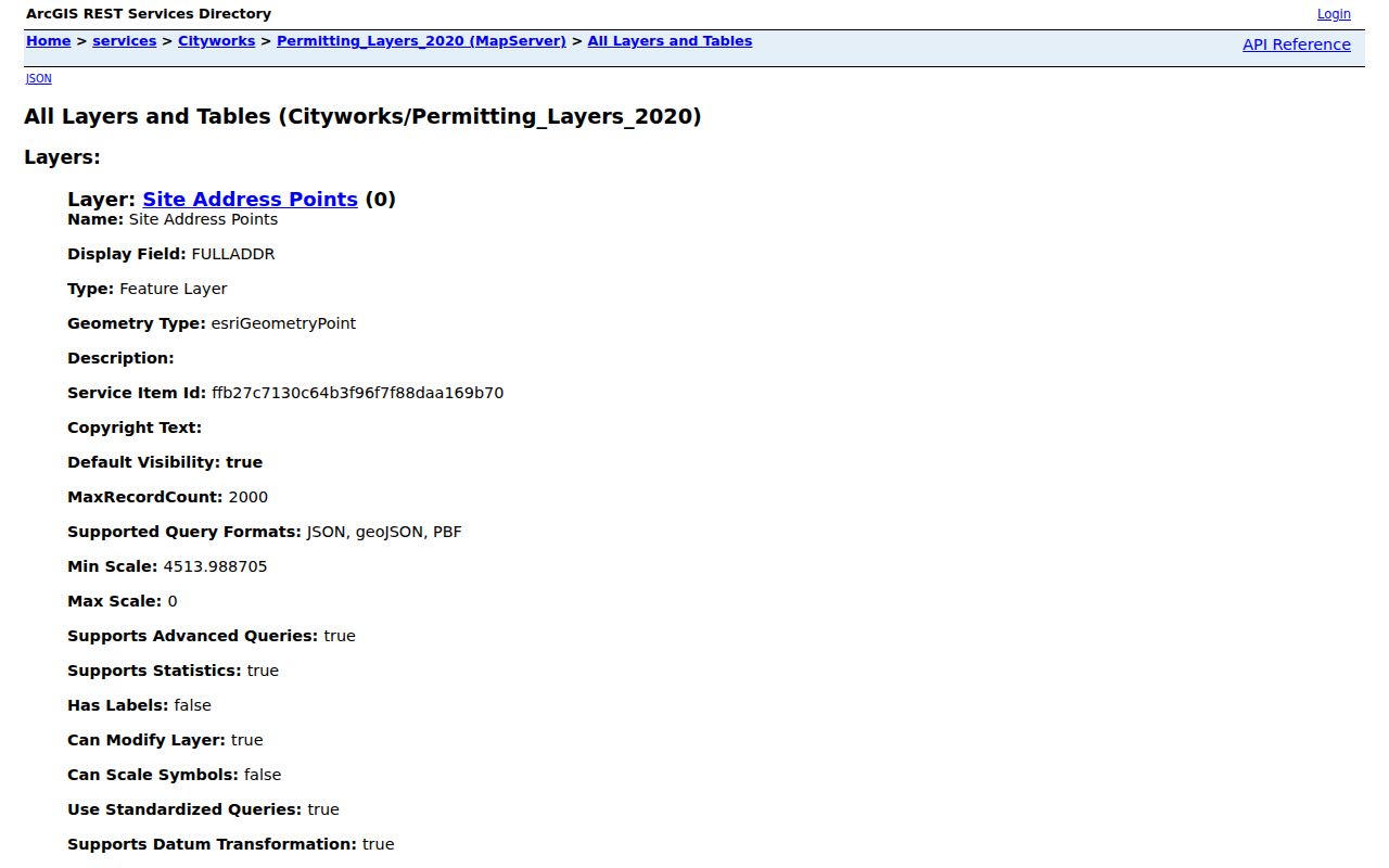
Deeds Along Greenwood Streets
The Johnson County Recorder keeps deeds, mortgages, and other recorded instruments. A sound street-by-street file records instrument number, recording date and time, grantor, grantee, document type, legal description, parcel number, book and page when shown, page count, and image or certification status. The Recorder page links remote Tapestry and subscriber Laredo routes. If remote access does not show the needed material, contact or visit the Recorder at the West Annex in Franklin.
Search by parcel as well as both party roles. State guidance says deeds and mortgages are indexed alphabetically by grantor and grantee with a concise legal description, date, and book or page. Inspection of a public record carries no search fee under Indiana's public-access rule, although copies or certifications may cost money. Research did not capture a live Johnson County result table or a public county-specific Tapestry price, so neither should be assumed.
A parcel split, combined tract, annexation, or changed legal description can break an apparent chain. Read the instrument rather than matching only the street label. That is especially important on a long Greenwood road where several parcels share a number pattern.
Greenwood Streets in Old Directories
Historical directories can place a listed person at a Greenwood address for one publication date. State Library holdings include Greenwood volumes for 1965, 1967, 1971 through 1972, and 1974, followed by Haines South Central Indiana directories spanning 1988 through 2013. Telephone-directory inventories add selected years from 1978 through 2019. The holdings list does not identify a separate Greenwood reverse-directory run.
Older city directories may contain a criss-cross section arranged by street. Start with the exact address as printed, inspect the abbreviation key, and compare nearby house numbers. If the question becomes a full historical collection search, consult the Greenwood city directories page. Physical and closed-stack access may be required because no Greenwood-specific digitized directory page was located.
Street names, parcel IDs, and municipal context can shift. Research found no exact citywide Greenwood renumbering year. Preserve that gap, then compare directories with Sanborn maps, plats, newspapers, deed descriptions, and annexation ordinances.
Greenwood Street Directory Limits
A Greenwood street directory assembled from public sources cannot prove every person who lives at an address. Assessment data concern value and tax administration. A deed identifies parties to a recorded transaction. A permit records a project role. A historical directory is a dated editorial snapshot. None is a live household roster, and a missing name does not prove that a person was absent.
Indiana's Address Confidentiality Program provides substitute-address protection for eligible participants, including special handling in voter records. Redactions and restricted records must remain protected. Utility-customer and motor-vehicle address data are not substitutes for the public parcel and address routes described here. For a particular city record, Greenwood's public-record policy calls for a written request identifying an existing record and allows lawful redactions; the city does not have to create a new list.
Lawful use. Use Greenwood address records only for lawful personal research, property questions, genealogy, or civic transparency. Never use them to stalk, harass, threaten, or harm a person.
Keep a dated evidence table with columns for address as printed, source and page, person or organization, stated role, parcel ID, and confidence. That small discipline prevents a modern owner name from being copied into the wrong year and keeps uncertain street directory conclusions clearly marked.